Sectional charts, often seen as a source of dread for many pilots, serve as intricate maps of airspace, vital for safe navigation. While traditional pilots may find them overwhelming, remote pilots like me, approach sectional charts with a different perspective. In this blog post, I’ll delve into the complexities of understanding airspace structure and how it impacts our operations and finally, demystifying sectional charts.

Understanding Airspace Structure:
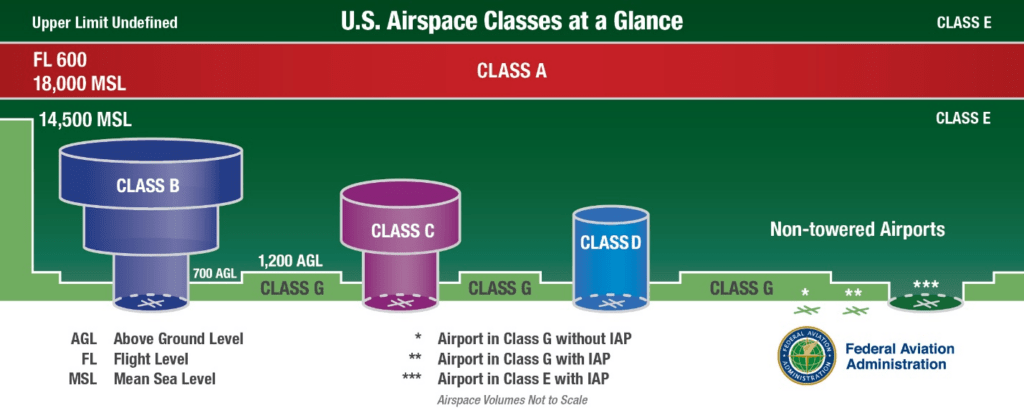
Airspace is divided into various classes, each with its own set of regulations and restrictions. Controlled airspace, designated by Class B, C, D, and E airspace, typically surrounds busy airports and extends for miles out. It’s crucial for remote pilots to understand these boundaries because controlled airspace requires prior authorization from the Air Traffic Controller, processed through the FAA Drone Zone website. The FAA recommends submitting requests 90 days prior to the planned flight, though quicker approvals are possible, with no guarantee.
Drones are restricted to a maximum altitude of 400 feet above ground level (AGL) or 400 feet above an obstacle being flown over. However, Class E airspace begins at 1200 feet AGL, except near small airports where it drops to 700 feet AGL. This lower floor increases the likelihood of interference between remote pilots and manned aircraft, underscoring the importance of airspace awareness and compliance.
For more information on airspace regulations and safety guidelines, visit the FAA’s website, where you can find detailed resources for drone pilots.

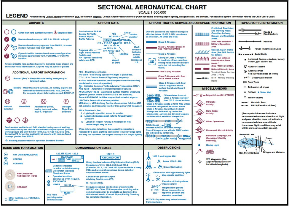
Explore the symbols and notations used on sectional charts with this comprehensive legend. Visit here to learn more.
Deciphering Sectional Charts:
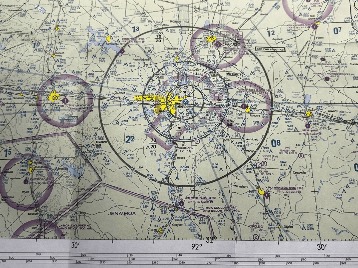
Sectional charts provide a visual representation of airspace boundaries, including controlled airspace, restricted areas, and special use airspace. Symbols and notations on sectional charts convey critical information about airports, navigation aids, terrain features, and airspace boundaries. Remote pilots must carefully analyze sectional charts to identify airspace classes and potential hazards that may impact their operations.
Explore airspace boundaries and practice chart interpretation using tools like SkyVector, an online resource for accessing sectional charts and flight planning.
Embracing the Challenge:
While sectional charts may appear daunting at first glance, they offer a fascinating glimpse into the complex world of airspace navigation. Each chart presents a unique challenge, requiring careful analysis and interpretation. By embracing this challenge, we transform sectional charts from intimidating obstacles into valuable learning tools.
Discover our commitment to FAA compliance and safety standards by visiting our About Us page, where you’ll find a dedicated section on our approach to maintaining regulatory compliance and ensuring safe drone operations.
Sectional charts may remain a source of frustration for many pilots, but for remote pilots like me, they offer a fascinating opportunity to understand the intricacies of airspace structure while demystifying sectional charts. By deciphering symbols, analyzing airspace boundaries, and maintaining awareness of drone regulations, we can navigate with confidence and appreciation for the invaluable information provided by sectional charts. So, the next time you find yourself face-to-face with a sectional chart, remember that it’s not just a map—it’s a gateway to understanding the skies above.
Ready to elevate your projects with stunning aerial imagery? Visit our Aerial Imagery Services page to learn more about how we can capture breathtaking perspectives for your needs.
Have questions or want to discuss your aerial photography needs further? Head over to our Contact Us page and get in touch with us today!


